Augmented Reality Indoor Navigation Positioning – Tracking Systems
Table of Contents
Augmented Reality Indoor Navigation: Overview of Available Tracking Systems and Solutions
How to use Apples indoor positioning, Bluetooth beacons, GPS or compass based positioning for Augmented Reality Indoor Navigation – here is an overview of tracking Systems and Solutions.
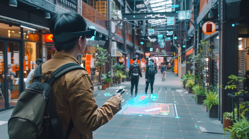
The starting point of a navigation application is to establish a permanent coordinate system – only then we can anchor virtual information in the physical world. Tracking systems are used to understand the 3D space and the user’s movement within it. But which one to use?
The release of Apple’s ARKit and Google’s ARCore significantly improved the robustness of AR apps, offering a seamless and effortless AR experience. Still, in the subject of spatial orientation, there is one more obstacle to overcome – real-world reference. The coordination system created by ARKit or ARCore has its origin in the location of the user at the moment the tracking has been initialized, resulting in different coordinates with each start of the application. In order to establish a permanent coordinate system, the application needs to know where the virtual space should be placed within the real-world environment. Depending on the scenario, there are several technologies to help with that.
Using image markers or QR codes would help to provide a permanent coordinate system, but they are not everyone’s favourite option. The currently available visual recognition systems (SLAM) don’t work in larger areas. Google VPS does this job very well, but it is not available as an SDK, unfortunately.
Positioning Systems
There are several indoor positioning approaches that provide a 2D or 3D coordinate that can then be used with the VIEWAR Fusion Tracking System. The VIEWAR tracking fusion system collects multiple less accurate positions and combines them with the movement curve provided by ARKit/ARCore.
Apple Indoor Maps
The indoor mapping system from Apple works with an existing WiFi connection to provide accurate positioning based on GPS-level. However, a GPS signal is not always sufficient for indoor navigation. For this, Apple also refers to radio frequency (RF) patterns.
Bluetooth Beacons
Beacons are small “senders” of Bluetooth signals, mounted on the wall or ceiling all over your location at a distance of 10-20 meters (30-60 feet). Depending on which beacons the device hears and how strong the signal is, it calculates an estimated position. Using beacons, you can estimate a position with an accuracy of 5–10 meters.
Compass Based Positioning
The compass has massive drifts indoors and is not that ideal for AR. Compass based positioning systems turn this disadvantage into an advantage. They measure the drift of a compass on certain positions and routes and use that for positioning. Users have to walk 10-30 meters to collect compass drift on multiple positions, looking for a match with the collected data. Compass based systems provide an accuracy of around 5-10 meters which makes them almost as accurate as Bluetooth beacons, with the disadvantage that the user has to move around for a position. Ideally, you combine Bluetooth beacons with compass based drift.
Bluetooth Ceiling Antennas
GPS
In outdoor environments, GPS can be used for positioning, providing output with an accuracy of 5-15 meters. We can also combine it with visual recognition of buildings to have accurate AR overlays.
Visual recognition and SLAM systems
Simultaneous Localization And Mapping (SLAM) is a technology allowing for constructing and updating a map of an unknown environment while simultaneously keeping track of an agent’s location within it. The app learns how an environment looks, creates a point cloud and re-localizes based on this. Most of the systems only work in smaller areas (200 square meters/2000 square feet) and the environment should not change. VIEWAR is currently testing and integrating new systems that also work for larger areas.
Markers/QR Codes
Placing markers and saving a location of that marker lets the app know where the user is. For some scenarios it is very handy to use QR codes for indoor positioning since the users need to be aware of the navigation applications and QR code used for app download link. Depending on the size of the marker, users can walk for a distance of 30 meters after filming a QR Code with a drift of 0,5-1,0 meter. This approach is simple, does not require complex installations and will work stable.
Tracking Systems – Comparison Table
| Name | Type | Accuracy | Setup* | Costs | Usability | VIEWAR** |
| Bluetooth Beacons | 2D | 3-8m | 3 | $ | +++ | Y |
| Compass based | 2D | 5-10m | 4 | $$ | ++ | Y |
| Apple Indoor Maps | 2D | 4-8m | 3 | $ | + | Y |
| Ceiling Antennas | 2D | 10-50cm | 5 | $$$ | +++ | Y |
| GPS | 2D | 5-15m | 1 | $ | ++ | Y |
| Visual Recognition / SLAM | 3D/6DoF | 10-30cm | 4 | $$ | + | Y |
| Markers / QR codes | 3D/6DoF | 5-15cm | 1 | $ | ++ | Y |
** Works /w VIEWAR Tracking Fusion System
Each of the technologies above has its own strengths and weaknesses. 2D positioning systems (GPS, beacons, ceiling antennas, Apple’s Indoor Positioning System) work quite well but come with high latency, low accuracy and no height information. Markers and visual recognition are difficult to scale and require user interaction.
VIEWAR Tracking Fusion System
The VIEWAR Tracking Fusion System collects multiple 2D with low accuracy and combines them with the movement of the device. The system can even combine multiple 2D inputs like Apple’s Indoor Positioning, beacons, ceiling antennas and compass based positioning considering each accuracy. By this, we can get a tracked pose (6 degrees of freedom – 6DoF) and also significantly increase the accuracy of the tracking systems used up to 10 times.
VIEWAR Fusion Tracking System is compatible with the following technologies:
- Visual Recognition and SLAM systems
- Apple’s Indoor Positioning System
- GPS
- Bluetooth Beacons
- Bluetooth Ceiling Antennas
- Markers / QR Codes
Using the VIEWAR SDK you can utilize all the tracking inputs above and create custom AR applications. Because the VIEWAR System is being continuously extended and maintained, your application will always be able to use the latest and best technologies. You can also test multiple tracking systems and find out which one works best for your location and your users.
Are you interested in using the VIEWAR Tracking Fusion System? Contact us!
Contact us at office@VIEWAR.com if you need more information about our products, want to schedule a demo call or need help to identify the most valuable AR use case for your business – our VIEWAR experts are happy to provide answer and assistance.
VIEWAR’s Indoor Navigation Templates
Currently, we offer two application templates with AR indoor navigation: INDOAR and GuideBOT
An indoor/outdoor navigation template with a virtual character’s guidance and assistance that may be replaced with your own customized character model. Routes are defined either through a browser-based admin interface or created directly within the app. A variety of tracking technologies is available to offer the right approach for every location scenario. The template can be extended with AI chatbot features and supports both text and voice input.
Industry 4.0 – Indoor Navigation & Remote Assistance
An all-round application for the industry. It combines the most needed features – indoor/outdoor navigation, remote assistance, and object tracking. Enriched with users and tasks management admin interface, it allows keeping the information in a coherent environment. Find out more about how to use Augmented Reality for your industry.